


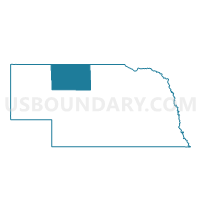
Cleveland Precinct, Cherry County, Nebraska
About
Outline

Summary
| Unique Area Identifier | 612589 |
| Name | Cleveland Precinct |
| County | Cherry County |
| State | Nebraska |
| Area (square miles) | 352.65 |
| Land Area (square miles) | 335.91 |
| Water Area (square miles) | 16.74 |
| % of Land Area | 95.25 |
| % of Water Area | 4.75 |
| Latitude of the Internal Point | 42.56437640 |
| Longtitude of the Internal Point | -100.63262290 |
Maps


Graphs
Select a template below for downloading or customizing gragh for Cleveland Precinct, Cherry County, Nebraska


Neighbors
Neighoring Voting District (by Name) Neighboring Voting District on the Map
- Barley Precinct, Cherry County, NE
- Goose Creek Precinct, Cherry County, NE
- Kennedy Precinct, Cherry County, NE
- Loup Precinct, Cherry County, NE
- South Valentine Precinct, Cherry County, NE
- Wood Lake Precinct, Cherry County, NE
Top 10 Neighboring County Subdivision (by Population) Neighboring County Subdivision on the Map
- Valentine precinct, Cherry County, NE (799)
- Loup precinct, Cherry County, NE (233)
- Wood Lake precinct, Cherry County, NE (169)
- Goose Creek precinct, Cherry County, NE (119)
- Cleveland precinct, Cherry County, NE (108)
- Barley precinct, Cherry County, NE (89)
- Kennedy precinct, Cherry County, NE (57)